Welwyn Garden City Photo Trail

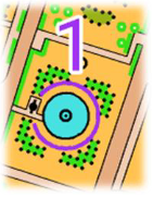
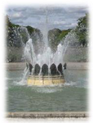
 Start anywhere. The Coronation Fountain at the top of Howardsgate in the town centre is control number 1 if you need a landmark. Simply match up the pictures to the numbered circles on the special orienteering map overleaf. Write the letter for each picture in the correct lettered box. Visit all the control points in any order (or as many as you feel like doing). Street names are omitted to make the challenge greater.
Scale. This is a large-scale map drawn at 1:4,000(at A3) or 1:6,000(atA4). That means that every one centimetre(or 10mm) on the map represents 40 metres (A3) or 60 metres (A4) on the ground.
Symbols. The map uses standard orienteering symbols. These are explained in the legend on the map. Yellow is used to show open areas, white to show wooded areas, and darker shades of green to show thicker trees.
Take care with traffic, especially if you are running. Cycles and electric cars are silent.
Please respect all private property. Do not enter private areas marked in olive green. You will be able to see all the control points from pavements and other public areas.
Observe the government’s current guidance on the precautions to control the coronavirus (COVID-19).
Walking suggestion. Visit some or all of the control points. Take time to learn some new things about people and placesfrom the history of the garden city.
Running Challenge. Visit all the control points. Use your skill to decide which is the most efficient order. Record the time it takes you. Try the controls in a different order on another day and see if you can beat your first time.
Running Time Challenge. Visit as many controls as you can in 30 minutes (returning to your start point). Use your skill to decide which controls to miss out (if any). Record the number of controls collected and deduct one control for every minute (or part of a minute) late. The optimum route to visit all the controls is between four and five kilometres.
Downloads:
Clue Sheet with details of all the control points
