Cassiobury (was Highfield Park)
28 May: We’re pleased to say that pre-registration is now available on http://sat.maptypes.org. Please do so if you can, it saves both you and us time on the day.
To avoid a clash with a football tournament in Highfield Park, we are running the event at Cassiobury that was postponed from 3 March because of snow. We are not expecting snow in June.
| Terrain |
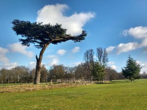 Runnable parkland with some wooded areas, some with significant undergrowth. The undergrowth was very low for the originally planned date of 3 March, but it will be higher in June. Full leg and torso cover required for Orange course and above. |
||||||||||||||||||
| Parking | Park at the Fullerians Rugby Club, Coningesby Drive, Watford, WD17 3PB. OS grid ref: TQ 089 977. Because there is building work in the rugby club pavilion, the event will be based in tents near the Langley Way entrance to the park, 200-400m walk from parking. Approach via Langley Way. See Google Maps Parking charge £1 per vehicle. |
||||||||||||||||||
| Public Transport | Watford Junction station 2.4km, Watford Metropolitan station 1.8km. From Watford Met please follow the path directly across the park in a NNE direction to Parkside Drive to avoid the competition area. | ||||||||||||||||||
| Courses | Courses for everybody from beginners of any age to experienced orienteers.
You may enter any course and will automatically be entered in the club’s Saturday League unless you ask not to. |
||||||||||||||||||
| Starts | Register from 09:45 to 11:15 or visit http://sat.maptypes.org to reserve map/dibber. Starts from 10:00 – 11:30. Courses close at 12:30.Start and Finish <200m from event centre. |
||||||||||||||||||
| Fees | Non-members: Adults £6, Juniors £3 BOF members: Adults £4, Juniors £1 Adults accompanying juniors are free, but £1 for an extra map. |
||||||||||||||||||
| Punching | Sportident punching will be used. Dibber hire £1.00. Charge for lost dibbers £30 |
||||||||||||||||||
| Map | 1:10000 with 5m contours, minor updates for this event.
Avoid all areas marked out of bounds, including the new children’s playground and pool areas. The golf course to the west of the map is out of bounds. |
||||||||||||||||||
| Facilities | Toilets in the park, within 200m of event centre, start and finish. The ice cream van may be there. | ||||||||||||||||||
| Dogs | Dogs permitted, but must be kept under control at all times and NOT ALLOWED ON THE RUGBY PITCHES near the parking. | ||||||||||||||||||
| Safety | The river and canal are deep; the river can be very muddy and the canal carries barge traffic. Use bridges – marked as crossing points on the map – to cross all bodies of water shown with a black border.
Please show respect to other users of the park. Orienteering is an adventure sport. You take part at your own risk and are responsible for your own safety. |
||||||||||||||||||
| Officials |
|